janvier 2014

Eulemur fulvus sanfordi, le Lémur brun de Sanford (Madagascar)
Le Lémur brun de Sanford, Eulemur fulvus sanfordi est un Lémurien de taille moyenne, environ 90 cm, possédant une queue plus longue (55 cm) ...

Brins Mesa
For years my uncle raved about Sedona, telling me how beautiful the red rock landscape was, and every Christmas would encourage me to visit ...

Pity the Sage Grouse, Victim of Politics
Sage Grouse (Wiki Commons) Sally Jewell, shiny new Secretary of the Interior , comes to northwest Colorado to discuss the threats to sage ...

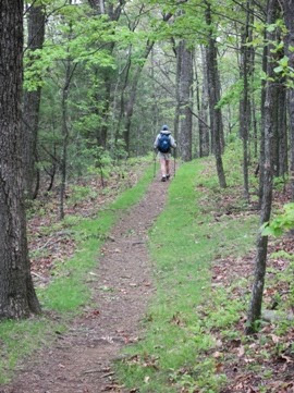
Are Backpackers Boycotting the Smokies?
Are backpackers boycotting the Smokies? Based on the number of backcountry overnight stays for 2013, I think you can say something definitel...
Blog Stew Spit from Nozzles
¶ In Switzerland, says BLDGBLOG , winter is sculpted " by one wizard-like figure who is really just a stoned twenty-something in a wool...


Towers o Power
As Hawaiian Petroglyphs Foretold, These Forms Rise Above the Land For whatever reason, this week offers multiple news stories about the ri...
Forest Visitors Urged to Avoid Ice on Waterways
The U.S. Forest Service is discouraging visitors to the Pisgah National Forest from walking on ice formed along area lakes and rivers. The w...
NC Wildlife Commission Helps Construct New Trails near Blue Ridge Parkway
Hikers interested in trails near the Blue Ridge Parkway now have three new trails to explore, thanks to a partnership involving private citi...

Study: Hikers are poorly able to recognize Lyme disease
According to an article recently published in Wilderness & Environmental Medicine, the official Journal of the Wilderness Medical Societ...


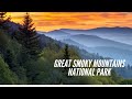
Great Smoky Mountains National Park
58NationalParks produced this excellent overview of Great Smoky Mountains National Park. If this video inspires you to visit the Smokies t...


Naches Peak
Although the Naches Peak Loop is considered to be a fairly popular hike, it doesn’t attract the crowds that some of Mt. Rainier’s star at...


Should cameras be installed on popular hiking trails?
Should cameras be installed on popular hiking trails? According to North Shore Rescue in British Columbia, Canada, the answer to that questi...

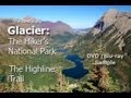
Highlighting the Highline Trail
Below is an excellent "hikelogue" from The West is Big! Travel Guides . The film highlights one of the best hikes in America. This...

More Ice
In my last post, I forgot the bell-bottomed ice-cicles. Not far below the blobular clusters, these stalacticicles dripped from overhanging...

The Great Smoky Mountains Scavenger Hunt
The time is now to gather your friends, family and co-workers to create a team! On March 22nd the Great Smoky Mountains Institute at Tremont...

Blog Stew Followed by Pie
¶ That there is, in fact, an actual place called Pie Town, New Mexico, continues to fascinate food writers. Going to Pie Town is compared t...


Ice Zoom
From 50 miles away, glaciers may gleam, but ice's intricacy is expressed simply as a reflection of the underlying landscape and overly...


