Related Posts Plugin for WordPress, Blogger...
Fourni par Blogger.

Clossiana euphrosyne, le Grand collier argenté

Le Grand collier argenté, Clossiana euphrosyne, papillon à la robe fauve orangée d'une envergure d'environ 4,5 cm ne pose pas trop de problème d'identification avec sa tache centrale blanc argenté au centre de la bande jaune du verso de ses ailes. Clossiana euphrosyne Grand collier argenté Ce Lépidoptère, appartenant à la famille des Nymphalidae fréquente plutôt les montagnes et semble


Smokies Hosts Public Meetings to Provide Updates on Roadwork Projects

Great Smoky Mountains National Park officials invite the public to a meeting for a project update on current and future roadwork plans for Newfound Gap Road and the Gatlinburg Bypass. The discussion will include details related to roadway resurfacing, drainage system improvements, stone-wall masonry rehabilitation, and slope stabilization in efforts to make these well-traveled roadways sustainable for continued vehicular travel by our 9 million visitors each year.


Meetings will be held on Monday, August 5th from 5:30 p.m. to 6:30 p.m. at the Sugarlands Visitor Center Training Room, near Gatlinburg, TN and on Tuesday, August 6th from 5:30 p.m. to 6:30 p.m. at the Oconaluftee Administrative Building near Cherokee, NC.


“We recognize that park roads such as Newfound Gap are critical arteries for traffic flow to and from our local communities,” said Superintendent Dale Ditmanson. “While the completion of these road projects will improve the park road conditions, we understand the project work creates a potential impact to our local communities. We look forward to sharing our design and project management details regarding how we will minimize these impacts to our visitors and park neighbors.”


During the meetings Park staff will provide information regarding four rehabilitation projects taking place in 2013 through 2016 including current work along 6.1 miles of Newfound Gap Road near Chimney’s Picnic Area south towards Newfound Gap and future projects including resurfacing of the Gatlinburg Bypass, slope stabilization along Newfound Gap Road near the Deep Creek trailhead, and roadway rehabilitation along Newfound Gap Road from Chimney’s Picnic Area north to Gatlinburg, TN.


For more information regarding the public meetings, contact the Public Affairs office at 865-436-1207 or 865-436-1203.


Jeff

Hiking in the Smokies


Just Yawning

Just Yawning

Blog update #5

Wow! 50,000 page views earlier today. Admittedly, about 20% seem to be bots, but I could never have thought that in less than two years I should get so many visits to this blog. I certainly hope those visitors find what they are looking for or at least something of interest when reading the blog.


I've been very busy the last few weeks and will continue to be in the weeks coming. This means that I may be a little slow in getting new blog posts up. I normally aim to get one up a week but this time frame might double in the near future. There is no shortage of material to discuss, I'm not sure there ever will be, but simply having the time to discuss the material is my biggest limitation.


In the coming months there is a few subjects that I'd like to post on. These are gold in the Orara River area, granites of the New England Batholith and touch on recent theories about the development of the Texas-Coffs Harbour Orocline/mega-fold.


In the mean time thanks to all my readers, regular or just those that have stumbled by. I appreciate your comments and questions and I try to get decent answers to all of them, so please keep commenting. If you have a detailed question or a picture or information that I might be interested in please email me. My email address can be found by clicking on the "About This Blog" tab at the top of the page and scrolling down.


Thank you too to my wife Beck who has edited and proof read many of my latest posts. The clarity of language and ease of reading has certainly increased dramatically since I have received her help.


NPS Denies Madison County Request to Establish New Park Entrance for Shenandoah

Shenandoah National Park Superintendent Jim Northup announced yesterday that he has denied Madison County's request to establish a new entrance for motor vehicles into the national park on Rapidan Road in Madison County.


In a six-page letter sent to County Administrator Mr. Ernie Hoch and the members of the Madison County Board of Supervisors, Northup said that he respected and appreciated Madison County's special relationship with former President Hoover and their pride in that history. However, Northup further advised the County that after careful consideration, he could not support the County's proposal to upgrade the lower section of the Rapidan Road nor open the upper section to public motor use for private cars and commercial van tours as called for in the County's May 6, 2013, proposal to the park.


In making his announcement Northup said, "I truly appreciate Madison County's interest in taking advantage of their proximity to Shenandoah National Park and looking for ways to better serve the visitors to our beautiful area. However, after careful review of the County's proposal and the laws, policies, and planning documents that guide my decisions as the park superintendent, I cannot support this particular proposal."


The County's proposal to the National Park Service contained three major components:


·a call to upgrade the lower section of the Rapidan Road, which is already open to public motor vehicle traffic and provides access to a portion of the park, the Rapidan State Wildlife Management Area, Rapidan Camps, Inc. (a private camp along the road), and the existing hiker and equestrian trailhead below the former Presidential Retreat, known as Camp Hoover or Rapidan Camp;


·a proposal to establish a new entrance for motor vehicles by opening the upper portion of the Rapidan Road (above the park gate);


·and a request to allow limited commercial vehicle access for guided van tours.


The County's proposal called for allowing nearly 30,000 vehicles per season to access the park from this new entrance. Similar proposals, advanced in 1939, 1947, and 1985 have also been denied by Presidential veto, the Secretary of the Interior, and a National Park Service Regional Director, respectively.


In responding to the County, Northup acknowledged that certain portions of the lower Rapidan Road are currently in rough condition, and indicated that the National Park Service would be willing to participate in further discussions with the County and other key stakeholders about modest improvements in the maintenance of the road, but could not support any significant change in the fundamental character or use of the road.In his letter, Northup pointed out that the "Lower" Rapidan Road is the only administrative road in all of Shenandoah National Park currently open to public motor vehicle use, and that in his opinion, the road is already fulfilling its essential, appropriate purpose of providing a rugged and backcountry experience to anglers and hunters within the State Wildlife Management Area, as well as, access for hikers and equestrians at the existing trailhead. Northup further advised the County that the park would be willing to discuss the possibility of a reputable tour company offering a walking tour to Rapidan Camp from the existing trailhead, but could not support opening the upper road to private motor vehicle use or commercial tours.In his letter, Northup also suggested other potential areas of collaboration between the County and the park, including exploring how the park can be helpful in reinvigorating "Hoover Days" – the annual celebration of the County's special relationship with President Hoover, which has waned in recent years.


In making his announcement, Northup said, "I look forward to working with all of our surrounding counties on appropriate projects to further develop the nature based and heritage education tourist economy in our area. But, Congress and the courts have repeatedly made it clear that my primary responsibility is to protect the natural and cultural resources of the park. After careful consideration of Madison County's proposal, it is my judgment that upgrading the lower section of the road, establishing a new entrance, and opening the upper Rapidan Road to motor vehicle use is not appropriate, nor consistent with the significance and purpose of this park."


Due to the high level of public interest in the proposal, the park's full response to Madison County is available for reading by clicking here .


Jeff

Hiking in the Smokies


Heart Attack Victim Saved in Shenandoah

NPS Digest is reporting this morning that on July 10th, Shenandoah National Park employees responded to a report of a 71-year-old man experiencing shortness of breath and chest pain on Dark Hollow Falls Trail, one of the most popular and steepest trails in the park.


A ranger/medic provided patient care until a litter team arrived and transported the man by wheeled litter to the park’s ambulance. An air evacuation was delayed by weather, but a ground ambulance with a cardiac monitor responded from Rockingham County Fire and Rescue.


The man went into cardiac arrest in the park ambulance while en route to the rendezvous with the county ambulance. The ranger/medic and another park employee began CPR and shocked the patient twice with an AED. Rockingham County Fire and Rescue took over patient care upon their arrival.


Due to a break in the weather, the helicopter was soon able to land. The team was able to reestablish a pulse and the man was conscious when he was flown to a cardiac cath lab. Later that day, the park received a report that he was sitting up and talking.


The responding flight nurse congratulated park staff for doing a “fabulous job” in keeping the man going until the helicopter could arrive. The early intervention provided by Shenandoah staff indisputably saved the man’s life.


Jeff

Hiking in the Smokies


Take Your Kid 'Squatching'

Introduce your kids to the outdoors by searching for the most elusive free-range primate of all: Bigfoot.


Tracks and other evidence were found.


Northern Colorado readers, doesn't this look like Roxborough State Park? I have never been there myself.


One Love Loop


Truth be told, it was just the odds catching up, I guess, but yesterday it felt like a spell was broken. For the past few laps around the sun, I've found out about concerts right after they happen. I'd be listening to Camper Van Beethoven one day when the computer was handy, I'd look up their tour dates, and see that they'd been in Seattle the night before. D'oh! At one point which I will memorialize as El Tiempo Los Losses, I missed Los Lobos and Los Lonely Boys in rapid succession, and then later the 20th Anniversary Lobos tour for Kiko, one of my favorite albums ever. Fucking D'oh.


This week, I looked up them and a bunch of other bands, because I had a hankering to see some music. Luckily, I hadn't just missed the Hackensaw Boys or some other band I've been waiting to hear for years. On the other hand, there was nothing going on that I wanted to hear.


So I went with the flow, which led me through the garden for a while, and then into the garage, where I turned on KAOS and looked for something to carve. As Chef Moss laid down the reggae beat, I picked up a piece of milo wood that I've probably had for 15 years. It's a little scrap of sapwood, chainsawed flat on two sides, no bigger than my hand. The reason I kept it is that it has this nice teardrop hole through it, and because it has a strong resemblance to certain Hawaiian ki'i (tiki). Strong enough that maybe that's why I never laid blade to it.


Yesterday, though, I picked it up and saw something completely different, and I sat and carved while the music played and the ripe sun shone softly.


Then I thought I heard the DJ say something about Mike Love and Paula Fuga being in town. KAOS being a friendly community station, I called in and found out that yeah, they were playing that night at the Olympia Ballroom. Touring as a trio this time around, I've been listening to them as Dubkonscious since 2005 or so, when I was mapping a Kona village with two other guys who played in the band. For years since, CDs of their two performance live on University of Hawai'i's Monday night Live (on KTUH, another friendly community station) have traveled with me all over.


So getting to see them was incredible. It was a good (and not crowded crowd), there to listen and dance. Paula's voice was beautiful and here style, just like it is in Dubkonscious and her solo album Lilikoi, is strong and individual. Mike Love's voice spoke in words, whistles and beyond (including a killer horn riff with no horn), while his hands played and thumped the guitar. Which is enough for most people, but he was busy with both feet making loops and adding effects, affecting several additional players up on stage. Sorry to say, I don't even know if percussionist and actual trio member Sam Ites was in Dubkonscious back when, but now his beats and vocals transformed the duo into something much more.


During their break, I picked up a Dubkonscious album, and talked to Paula and Mike for a while. Actually, I got them to sign the first KTUH disk, and found out that they don't have the second one, so I can burn one for them. I think they were happy to see a disk (the Kona-mapping bass-player's handwriting on it) from so far back, and know that a person has been listening to the whole time. Paula told me that the guy who made the CD for me now lives in Washington!


Maybe there's nothing special, and it really was bound to happen that I'd find out about a concert before it happened, but I'm not gonna look at it that way. As I sat and carved that wood, looping around the hole, the spell broke and the flow was restored. The music played and looped, a recording from years away circled back to find it's singers, and I found an old friend living in the NW. I'm gonna be all non-sciency and think that this is One Love at work.


Old Railroad Trestle

This old railroad trestle is still in use in rural Jackson County, Florida.


IMG_8422


Windy DayZ

Windy DayZ

Rangers In Swiftwater Rescue Course Rescue Several Boaters

While participating in a 40-hour swiftwater rescue technician certification training course on the Chattahoochee River on Friday, July 12th, rangers Jay Kolodzinski and James Psillis, supervisory ranger Sean Perchalski, and members of two local fire departments performed four rescues involving seven visitors.


Due to heavy rains over the last several weeks, the training was conducted in extreme conditions with water flow rates of up to 10,000 cubic feet per second (cfs) on a river where normal flow rates hover around 1,200 cfs. Water temperatures around 50 degrees Fahrenheit also made hypothermia a risk.


On Friday, the fifth and final day of the training, course participants were scheduled to perform a search and rescue exercise. As the exercise got underway, they encountered several visitors whose canoes and kayaks had overturned and been swept away in the current. In cooperation with their classmates, the three Chattahoochee River NRA rangers rescued all seven visitors before regrouping to successfully complete a staged night exercise utilizing the incident command system and operational leadership.


A total of sixteen participants completed the swiftwater rescue training course, practicing rescue techniques and tactics on both the Chattahoochee River and the Amicalola River in north Georgia.


Jeff

Hiking in the Smokies


How dry has it been? Tumbleweed Dry

I mowed the lawn at the guest cabin today — such is the payoff after having more than four inches of rain this month.


But it has been dry. How dry has it been? It has been so dry that the usual invasive weeds such as bindweed are gone, except around the flower bed where they can steal some water.


Instead, the area where all the grass died (previous owner planted bluegrass, which survived the late 1990s but not the 2000s) has been colonized by kochia and Russian thistle (tumblin' tumbleweed).


I have never seen tumbleweed growing around here before. I mowed every bit of it that I could find, hoping to stop it from flowering — the tumbling spreads its gazillions of seeds.


Special Evening Hike to Showcase Hidden Stories of Cumbelrand Gap

The staff at Cumberland Gap National Historical Park eagerly heralds the third annual “Within the Shadows of Cumberland Gap Heritage Walk” being held next Saturday, August 3rd, 2013. Each year, some of the lesser-known people in the Gap’s history - from geologists to politicians, from scalp buyers to ancestors of presidents - are showcased. This year, visitors will encounter seven short plays along the Wilderness Road that may surprise even those who think they know all about the Cumberland Gap!


“We tend to think of people such as Daniel Boone and Civil War generals at the Cumberland Gap, but there were thousands of other people who traveled through this historic passageway” explained park historian Martha Wiley. “This is our chance to share with park visitors and neighbors some of these ‘hidden history’ stories. It’s a lot of fun for park staff and volunteers to be able to portray some of these riveting characters from our past!”


Rangers will be leading three hikes along the Wilderness Road with the first one beginning at 6:00 p.m., the next at 6:30, and the final at 7:00 p.m. Each hike will take approximately 90 minutes traversing 1.5 miles on a dirt trail with hilly sections; good walking shoes are required. This popular event is free, but each tour is limited to 30 people, so reservations are recommended by calling the park visitor center at (606) 246-1075.


Visitors should be at the Daniel Boone Visitor Information Center above the town of Cumberland Gap, Tennessee, 30 minutes prior to the scheduled tour time, as shuttles will take visitors to the starting point at the Thomas Walker parking area. In case of heavy rain the event will be cancelled.


This program is being co-hosted by the Friends of Cumberland Gap and park partner Eastern National. For more information about Cumberland Gap National Historical Park, please call (606) 248-2817 or visit www.nps.gov/cuga . For more information on the Friends of Cumberland Gap National Historical Park and how to become involved, please visit www.friendsofcumberlandgap.org . Learn how Eastern National supports the interpretive and educational mission of the National Park Service by visiting www.easternnational.org .


Jeff

Hiking in the Smokies


2013 Trails Forever Volunteer Workday Schedule

The Trails Forever crew is looking for a few volunteers to help with trail maintenance in the Smokies over the next several weeks.


The volunteer workdays for these projects will begin Wednesday, July 31st, and occur every Wednesday for the remainder of the season. Volunteers will work to complete a variety of trail rehabilitation tasks - volunteers need to be physically able to hike to the work site and perform manual labor for a 10 hour day. There is a limit of 4 volunteers for each of the workdays. You must sign up in advance and complete paperwork prior to arriving to volunteer with the crew. Once you sign up and secure a spot for one of the workdays, you will receive more details.


2013 Volunteer Workdays:


July 31st

August 7th

August 14th

August 21st

August 28th

September 4th

September 11th

September 18th

September 25th

October 2nd

October 9th

October 16th


For more information or to sign up for one of the workdays, please call 865-436-1265 or email christine_hoyer@nps.gov .


Jeff

Hiking in the Smokies


Forsake Fossil Fuel


Of all the energy sources powering the blogosphere, dissatisfaction with the status quo ranks pretty high. From carefully constructed criticism to ad hoc rants, blogs complain about where we are, where we were, and where we're headed. Often as not, the blogger thinks that by calling out some flaw, highlighting a problem, readers might be inspired to change their minds, maybe even take positive action. But the status quo is one hell of a grindstone, and while a brilliant critique may nick it, more often the critic is worn down. Once in a great while, some random or sudden event may lead to change, but more often it is action, collective and directed and occurring in the non-cyber world, that re-shapes the monolith.


The ways we power our society, by burning fossil fuel and by coaxing electrons from rivers or water, wind, and photons, has been a recurring subject here at Mojourner Truth. Sometimes, I've argued against continuing to rely on oil and coal, but of my small audience, I have a feeling that many agree already, and doubt that my words pulled anyone off the grid. Other times, I've extolled the virtues of renewable energy and low-tech efficiencies, but how many people have a heatilator? Blogging is impotence, published.


Recently, though, I actually took action that may make a real difference. For the past year, I've gotten a small block of my energy from renewables. The utility offers you the opportunity to purchase your energy just from wind, hydro, solar, and reclaimed methane, $4 at a time. A month or two ago, I switched to 100% renewable. It costs marginally more, but since I'm not much of a power consumer (no air conditioner, no TV, and a near-Ludditic reliance on muscle-powered gear rather than electro-gadgets), electricity overall is a minor part of my cost of living.


I am not quite so green as Ed Begley in that Simpsons episode where he speeds off in a car "powered by my own sense of self-satisfaction," but my 100% renewable electricity does have me feeling pretty smug. And the more people who do this, the less incentive industry has to drill and frack up the earth. I don't share many Americans' belief in the magic of The Market, but I do understand that changes in consumer choice affect what's for sale, and if we collectively choose renewable energy (imperfect as it may be), maybe a mountain in West Virginia doesn't get flattened, maybe a midwest aquifer won't be pumped full of frack-chemicals, maybe the climate will stabilize.


An extra 1.25 cents per kilowatt-hour buys me this non-fossil energy. The energy company says that for a typical house, the environmental benefit is equivalent to taking a car off the road. But there's also no military cost to using power that is 100% domestic. It's a small act, but it's meaningful, and in aggregate, it will help shift us away from our dangerous reliance on oil, gas, and coal that are killing us and ruining the earth for our progeny.


Twelve Injured By Lightning In Two Separate Incidents on Blue Ridge Parkway

NPS Digest is reporting this morning that twelve Blue Ridge Parkway visitors were injured - two of them were hospitalized - after being struck indirectly by lightning in two separate incidents - one week apart.


On July 10th, a lightning strike at the Linville Falls Campground affected 10 people who were camping adjacent to each other – a family group of eight and two other separate campers. All self-reported to the hospital and were treated and released, except for one 37-year-old woman who was kept overnight for evaluation due to cardiac issues. She was released the following morning.


On July 17th, a husband and wife from Conover, North Carolina, were traveling the parkway and stopped at Grandfather Mountain Overlook to don rain gear when it began to rain. While at the overlook, lightning struck a nearby hemlock tree, knocking the couple off their feet. The wife began experiencing cardiac issues and eventually went into cardiac arrest. Her husband began CPR and revived her. Both were initially transported to Cannon Hospital in Linville Falls, where the husband was treated and released. The wife was transported to Charlotte, North Carolina, for further treatment and evaluation.


At least 17 people were struck by lightning during this same time frame: 4 in the Grand Canyon, 3 in Glacier National Park , 9 on a farm in Colorado, and 1 in Rocky Mountain National Park .


Hikers and outdoor recreationalists should know what to do in case you're ever caught in the backcountry during a thunderstorm .


Jeff

Hiking in the Smokies


Summer Ranger Programs in Shenandoah National Park

With a little over a month left before Ranger Programs shift to their fall schedule, the time is now to plan to get out and see Shenandoah National Park in the company of the professionals who know it best. This summer’s Ranger Programs calendar features a total of 23 regularly scheduled hikes, talks, and programs spread between each of the Park’s three districts. Here’s a sampling of what’s offered:


North District:


Terrace Talk: An informal ranger talk on various subjects. 20-30 minutes. Daily at 10:30 am at DickeyRidgeVisitorCenter (mile 4.6).


Wild About Bears: Learn about Shenandoah’s largest animal. 20-30 minutes. Daily at 2:00 pm at Elkwallow Wayside (mile 24.1).


Snead Farm Stroll: Leisurely hike to a former apple orchard and family farm and cemetery. 2 hours, 1.5 miles. Mon-Wed-Fri at 3:00 at the south end of Dickey Ridge Picnic Grounds (mile 4.6).


Mount Marshall Hike: Hike part of the Appalachian Trail to a spectacular view of Shenandoah Valley. 2 hours, 1.5 miles. Sun-Tues-Thurs-Sat at 3:00 at the MountMarshall parking lot (mile 15.9).


Central District:


Stony Man Hike: This moderately challenging hike takes you to an historic copper mine and to the home for some rare animals and plants. 2 hours, 2 miles. Daily at 10:00 am at the Stony Man Trailhead (mile 41.7).


Massanutten Lodge Open House: Explore a restored bungalow from the early days of Skyland resort. Open daily between the hours of 3:00 and 5:00 on the lower road at Skyland Conference Hall (mile 41.7)


Meadow Walk: An easy, guided stroll exploring the wonders of this rare high-elevation wetland. 1.5 hours, 1 mile. Daily at 11:00 am at ByrdVisitorCenter (mile 51). Evening walks Mon and Wed at 7:30.


Birds of Prey: Meet a live raptor and learn how protected lands like Shenandoah aid its survival. 30 minutes. Sun-Tues-Wed-Thurs-Sat at 10:00 am at Big Meadows Amphitheater (mile 51).


South District:


Blackrock Summit Hike: A moderately challenging short loop to a popular summit with great views of Shenandoah Valley. 1.5 hours, 1 mile. Daily at 10:00 am at the Blackrock Summit Parking Area (mile 84.8).


Bears, Bats, Bobcats, and More: A ranger talk on the wild creatures of Shenandoah. 20-30 minutes. Daily at 1:30 pm at Loft Mountain Wayside (mile 79.5).


For a complete listing, and more details about each offering, please click here .


Jeff

Hiking in the Smokies


August Classic Hikes of the Smokies: Mt. Sterling Vistas


On the third Tuesday of each month this year, Friends of the Smokies will be offering guided hikes as part of their Classic Hikes of the Smokies series. To celebrate the Friends’ 20th anniversary this year, each hike will honor an achievement or cause that the Friends organization has supported in Great Smoky Mountains National Park since its establishment in 1993.


The hike for next month will honor air quality:


August 20: Mt. Sterling Vistas

Distance: 5.4 miles

Elevation Gain: 2000 feet

Trails – Mt Sterling Trail


To help support the Smokies Trails Forever program, a donation of $10 for members and $35 for non-members is requested. Non-members receive a complimentary membership to Friends of the Smokies. Members who bring a friend hike for free. You can pre-register for this through Friends of the Smokies at outreach.nc@friendsofthesmokies.org or 828-452-0720.


Jeff

Hiking in the Smokies


Dying for Beauty


The Wave (Wikimedia Commons)


You have heard of the Darwin Awards. I propose the Everett Ruess Award.


Ruess was a young California artist who sought inspiration in the southern Utah canyonlands beginning in 1931, nearly dying of dehydration at least once, before he disappeared for good in 1934. "Beauty" was one of his favorite words.


Lately the fatal lure is a rock formation called the Wave. Three people have died this month hiking to and from it.

The Wave is a richly colored geological upheaval, its fiery swirls emblazoned on postcards, posters, maps and computer screensavers. It is said to be one of the most photographed spots in North America.

Ironically, you have to apply for a permit to hike there, it is so popular.

Half of the 20 daily permits are doled out on a walk-in basis at a visitor's center in Kanab, with up to 100 people showing up for each one. For many, it's a lifetime opportunity that can encourage risk-taking during the hottest time of the year.


Building a Treehouse


That dog is one hell of a supervisor.


A couple weekends ago, the kids and I built a treehouse. I guess "house" is an exaggeration: no walls, no roof, and not much room. But, it is attached to a tree, and you do have to climb a ladder to get there.


Some people think vice is not a good foundation, but occasionally it works out. (That black thing in back is the bumper-seat, not haging beneath the structure.)


The treehouse begins with the tree. In this case, no dendritic cradle, and not even any useful branches, just a slightly off vertical pillar of conifer. For that reason, and because I rent this place and may be required to tear it down someday,* my idea was to use 2" x 8" boards more or less like a vice. Four threaded steel rods, bolted tightly together clamp the boards to the tree (a couple of nails held them in place during drilling and tightening, but would not be enough to support weight by themselves). The result is that the treehouse is minimally bothersome to the tree; as it grows, the bark below will swell a bit, increasing the support. The bolts could be loosened if it looks like the tree is getting squeezed too much, but I doubt that will happen.


Architecturally, I think treehouses should be vernacular and adaptive, expressions of the tree and the inhabitants, and not a static imposed design. So the basic cantilevered vice idea, which may have supported the kids, but not me, required some changing, and we added posts to the outer end of the beams. The joists, rather than being parallel and evenly spaces, radiate slightly to accomodate the geometry of our platform, and the sheet of plywood for the floor has a cutout that hugs the tree.


Those posts express another aspect that I've always thought crucial to a genuine treehouse:they are salvaged. Each consists of a couple of 2 x 4's that used to be a neighbor's bathroom wall, nailed together and cut to fit the odd lengths between beam and the rocks I dragged into place. Ascent is by means of half a step ladder whose braces and other half were getting rickety, and wwas removed; it is lashed into place with some rope salvaged from a boat headed to a landfill.


Almost done. The skinny post was a temporary support, and the real ladder is not in place, but you get the idea.


The treehouse will continue to evolve, and the kids will accesorize it. Already, we added a seat beneath, consisting of a big floating boat bumper suspended from more of that rope. The space beneath the floor, I should mention, was designed so I can stand up under it, out of the rain. The campfire ring nearby may need to scoot over a few feet for safety's sake, but will remain along with the sod-sofa that has been in place ever since I dug the last garden bed. Together, they are becoming a nice little outdoor living space.


Local Teachers and Students Become Park Rangers

Great Smoky Mountains Park officials announced the completion of two unique summer programs engaging selected high school students and teachers as park rangers. The Teacher-Ranger-Teacher and the High School Student Intern programs are six-week paid work experiences where participants learn a great deal about the park through on-site training exercises that enable them to perform ranger duties. Participants will complete the programs just in time for the new school year allowing them to return to the classroom with a wealth of knowledge and experience gained from a summer working with rangers in the park.


“These programs are mutually beneficial,” said the park’s Education Specialist Karen Ballentine. “The students and teachers get an in-depth study of resource education techniques, scientific methods, and field research to enhance their skills and talents, and, in turn, the park creates advocates through better understanding of and appreciation for the Smokies. Teachers will bring the knowledge into their classrooms and the interns will share their education and experience with the local community through their friends and family.”


During their time in the park, teachers work alongside park rangers in the field assisting with resource management activities and education programs. When not in the field, teachers are working with Resource Educators to develop elementary, middle, and high school curriculum for the popular Parks as Classrooms program.


Student interns, from different local high schools within the surrounding counties and communities, assist scientists and park staff with field research and education programs while exploring possible career opportunities. They get exposed to and gain knowledge about a variety of areas while working in the park, including wildlife biology, fisheries science, botany, forest and stream ecology, geology, Cherokee history and culture, Appalachian history, and park management.


The two successful programs were expanded this summer, thanks to a variety of public and private funding sources. Grants were received from the Verizon Foundation, the National Park Foundation’s Park Stewards program, and GlaxoSmithKline Foundation’s Ribbon of Hope fund through Friends of the Smokies and the federally-funded Youth Partnership Program (YPP) These funds supported six teachers and 23 high school students from Tennessee and North Carolina school systems. Additionally, the YPP grant supported four intern positions based out of Great Smoky Mountains Institute at Tremont who assisted with summer camp and research projects.


Jeff

Hiking in the Smokies


GAO Report Identifies Maintenance Gaps on National Forest Trails

The U.S. Government Accountability Office (GAO) was recently asked by members of Congress to review the U.S. Forest Service's trail maintenance activities. The study, published in late June, concluded that while the Forest Service does a good job overall of offering trail-users recreational opportunities and maintaining the most popular trails, there remains a significant maintenance backlog, the result of a growing gap between trail maintenance needs and available resources.


The study points out that the Forest Service has more miles of trail than it has been able to maintain, resulting in a persistent maintenance backlog with a range of negative effects. In fiscal year 2012, the agency reported that it accomplished at least some maintenance on about 37% of its 158,000 trail miles, and that about one-quarter of its trail miles met the agency's standards. The Forest Service estimated the value of its trail maintenance backlog to be $314 million in fiscal year 2012, with an additional $210 million for annual maintenance, capital improvement, and operations. Trails not maintained to quality standards have a range of negative effects, such as inhibiting trail use and harming natural resources, and deferring maintenance can add to maintenance costs.


The Forest Service relies on a combination of internal and external resources to help maintain its trail system. Internal resources include about $80 million allocated annually for trail maintenance activities, plus funding for other agency programs that involve trails. External resources include volunteer labor, which the Forest Service valued at $26 million in fiscal year 2012, and funding from federal programs, states, and other sources.


Collectively, agency officials and stakeholders GAO spoke with identified a number of factors complicating the Forest Service's trail maintenance efforts, including:


1) Factors associated with the origin and location of trails


2) Some agency policies and procedures


3) Factors associated with the management of volunteers and other external resources


For example, many trails were created for purposes other than recreation, such as access for timber harvesting or firefighting, and some were built on steep slopes, leaving unsustainable, erosion-prone trails that require continual maintenance. In addition, certain agency policies and procedures complicate trail maintenance efforts, such as the agency's lack of standardized training in trails field skills, which limits agency expertise. Further, while volunteers are important to the agency's trail maintenance efforts, managing volunteers can decrease the time officials can spend performing on-the-ground maintenance.


Agency officials and stakeholders GAO interviewed collectively identified numerous options to improve Forest Service trail maintenance, including:


1) Assessing the sustainability of the trail system


2) Improving agency policies and procedures


3) Improving management of volunteers and other external resources.


In a 2010 document titled A Framework for Sustainable Recreation, the Forest Service noted the importance of analyzing recreation program needs and available resources and assessing potential ways to narrow the gap between them, which the agency has not yet done for its trails. Many officials and stakeholders suggested that the agency systematically assess its trail system to identify ways to reduce the gap and improve trail system sustainability. They also identified other options for improving management of volunteers. For example, while the agency's goal in the Forest Service Manual is to use volunteers, the agency has not established collaboration with and management of volunteers who help maintain trails as clear expectations for trails staff responsible for working with volunteers, and training in this area is limited. Some agency officials and stakeholders stated that training on how to collaborate with and manage volunteers would enhance the agency's ability to capitalize on this resource.


In commenting on a draft of the report, the U.S. Forest Service generally agreed with GAO's findings and recommendations. You can read the full report by clicking here .


Jeff

Hiking in the Smokies


Colorado's Redwoods


The Big Stump, a fossilized redwood, was once the pride of a commercial resort at the site. The tree would have been a little larger than the ponderosa pines now growing around it.

Taller and faster-growing, Colorado's redwoods were in all respects better than those in California — except for having flourished 34 million years ago, before a series of volcanic eruptions suffocated them.


Flash forward to the 1870s, when residents of Colorado Springs could take an excursion train west into the mountains and wander through the petrified logs exposed on the ground, chipping away bits to take home and place on the mantelpiece or in their flower beds.


Visitors chipped away so industriously that the logs are gone, except for those still buried. A generation later, two adjacent commercial establishments controlled the fossil beds, each one part dude ranch, part museum, and part fresh-air resort.


Only in 1969 did the area become the Florissant Fossil Beds National Monument, which also showcases fossils of quite a few plants, vertebrates, and invertebrates, preserved in volcanic ash.


M. and I stopped by in June 2013 for the first time in (non-geological) ages. We found the new park visitor center and more trails and signage than we remembered.


Too many visitors don't get far from the vistor center. That is actually a stump in the pit, surrounded by a supporting band of steel.


I poop on your signage.

The easy half-mile Ponderosa Loop Trail includes photos of the previous commercial establishments at the fossil bed, as well as a time line of geology and life at the site. Here a modern dinosaur appears to have left some comments on one of the signs.


The monument covers 6,000 acres, and there are 14–15 miles of hiking trails, depending which brochure you read.


We walked another three-mile loop, which crossed the Homestake Pipeline, part of Colorado Springs' water system. The pipeline carries water from a collection system near Aspen, with its flow shared by Aurora and Colorado Springs.


(It's amazing how many Springs residents think their water comes from snow on Pike's Peak, and Aurorans probably don't think at all about it.)


Despite its significance in our hydraulic civilization, the pipeline rates no signage on the hiking trail. Apparently it does not fit the narrative of the fossil beds.


The cleared strip marks the route of the Homestake Pipline through the hills west of Colorado Springs. It was built just before the national monument was created.


Project AWARE 2013

Project AWARE 2013

Yellow Wooly Bear Moth

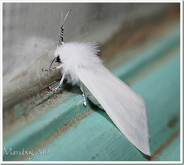
This pretty critter looks like it’s wearing a fur trimmed cape. I love God’s humor when it pertains to some of his creations!


Yellow Wooly Bear Moth


Coming to Terms with the Pike


A typical view on the Pike's Peak Ranger District

When I lived further north, I spent a lot of time on the Pike National Forest, and by "the Pike" in this context I mean chiefly the Pike's Peak Ranger District and the southern part of the South Platte Ranger District — in other words, an area northwest of Colorado Springs and southwest of Denver.


I camped, hiked, and hunted. I planted trees with the Boy Scouts, trees that probably burned in one of the many forest fires in the Buffalo Creek area since those days.


But I never loved it. When I saw views that opened up after the big Hayman Fire in 2002, I kind of thought that was an improvement, heretical as it may sound.


Signal Butte rises north of Florissant, Colorado.

M. and I went back to the Pike last month — we were camping with friends near Florissant, and we took a day to reacquaint ourselves with that corner of the forest, see some places that we had not seen since our days in Manitou Springs, and just get out and walk in the woods.


A typical forest road in a typical draw on the Pike.

Somehow, driving and walking — and seeing different vistas of the burn — kind of put me at ease. I felt a little more like I knew the place — or could know it, if I wanted to spend the time. But I probably won't. I like it here better.


Smokies To Host Storyteller Doug Elliott

Great Smoky Mountains National Park officials invite the public to attend a special program titled Stories, Songs, and Lore Celebrating the Natural World presented by well-known naturalist storyteller Doug Elliott. The hour-long program will be held on the porch of the Oconaluftee Visitor Center on Friday, July 26 at 1 pm.


Elliott is a naturalist, herbalist, storyteller, basket maker, philosopher, and harmonica player. He has performed at festivals, museums and schools from Canada to the Caribbean, and has been a featured storyteller at the National Storytelling Festival in Jonesborough, TN. He has conducted workshops and programs at the American Museum of Natural History in New York, the Royal Ontario Museum in Toronto and the Smithsonian Institution. He has trained rangers for the National Park Service and guided people on wilderness experiences from Maine to the Florida Everglades. He was named harmonica champion at Fiddler's Grove Festival in Union Grove, N.C.


“We are delighted to offer this opportunity to the public free of charge,” said Lynda Doucette, Supervisory Park Ranger. “This is a chance for families to enjoy an hour of fun and learning as Doug weaves stories of natural history in the Great Smoky Mountains.”


Elliott regularly writes articles for regional and national magazines, and has authored five books, produced a number of award winning recordings of stories and songs, and is occasionally seen on PBS-TV and the History Channel.


The Oconaluftee Visitor Center is located on U.S. Highway 441, 2 miles north of Cherokee, NC. For more information call the park’s Oconaluftee Visitor Center at (828) 497-1904.


Jeff

Hiking in the Smokies


Dwarf Crested Iris

Another gorgeous bloom from the Great Smoky Mountains


IMG_8343


Section of Blue Ridge Parkway Closed Due to Cracks in the Pavement

A 21-mile section of the historic 469-mile Blue Ridge Parkway in North Carolina is closed from Milepost 376 at Ox Creek Road, to Milepost 355 at Mt. Mitchell State Park. A detour route is available that directs traffic from Asheville, NC, along Interstate 40 to U.S. Route 221, back to the Parkway at Spruce Pine, NC, and alternately from Spruce Pine south to Asheville via U.S. Route 221 and Interstate 40.


The closure is the result of significant structural damage to a section of the motor road and related shoulder areas at Milepost 374.5 caused by recent, prolonged heavy rains. Federal Highway Administration engineers have been called in to assist park managers in determining the extent of the damage and will make recommendations for necessary repairs. The Parkway will release additional information once a construction and repair schedule is established. The public is encouraged to use the park's website to access road information to plan their visit.


To ensure public safety, the affected area of Parkway is closed to all motorized traffic until further notice. Currently pedestrians and bicyclists are allowed use of the closed area; however, once construction begins, or if conditions change, the area will be closed to all visitor access. Mt. Mitchell State Park will remain open, which is accessible from the northern approach along the Blue Ridge Parkway from Milepost 330, at Spruce Pine, NC, or from state Route 80. The Craggy Gardens Visitor Center and Picnic Area, at Milepost 364, will remain closed for the duration of the repair project.


Parkway management has apologized for any inconvenience to visitors and local communities impacted by the closure.


Jeff

Hiking in the Smokies


Civil War Music with Sparky and Rhonda Rucker at Sugarlands Visitor Center

Great Smoky Mountains National Park has announced a free special music program featuring old-time musicians Sparky and Rhonda Rucker. The event will take place at 11 a.m. and 1 p.m. on Saturday, July 20th in the park Sugarlands Visitor Center theater.


The program will focus on the Civil War and its impacts on the Southern Appalachian Region, and will include stories, period music, and personal reflections on the war and its effects on the mountain people.


Sparky and Rhonda have performed throughout the United States, singing songs and telling stories. Sparky Rucker has been performing over 40 years and is internationally recognized as a leading folklorist, musician, historian, storyteller, and author. Rhonda Rucker is an accomplished harmonica and piano player, and also adds vocal harmonies to their songs.


“We’re excited to have Sparky and Rhonda return to Sugarlands this summer,” said supervisory ranger Kent Cave. “As we continue to commemorate the Civil War’s sesquicentennial, this performance will be an entertaining and interesting way to learn more about the unique history of the war in these mountains.”


Sugarlands Visitor Center is located on U.S. Highway 441, two miles south of Gatlinburg, TN. For more information call the visitor center at (865) 436-1291.


Jeff

Hiking in the Smokies


Guided Hike to a Big South Fork Rock Shelter this Sunday

A ranger guided hike to a rock shelter along the Oscar Blevins Trail will take place on Sunday, July 21st, near the Bandy Creek Visitor Center in Big South Fork National River and Recreation Area. On this moderate two mile hike, visitors will learn about plants and animals in the park, hear about park history, and will be able to view rock shelters along the trail.


The hike will begin at 10:00 a.m. (EDT) on the front porch of the Bandy Creek Visitor Center. In case of inclement weather, a talk will be held in the Interpretation and Education Building located beside the Visitor Center.


Everyone is welcome. For more information, contact the Bandy Creek Visitor Center at (423) 286-7275.


Jeff

Hiking in the Smokies


Mammoth Cave National Park – what does it mean to you?

Mammoth Cave National Park – what does it mean to you? That's what Superintendent Sarah Craighead is asking as Mammoth Cave National Park prepares a foundation document for its future planning and management. Public comment is welcome and needed. The public comment period is open July 15-29, 2013.


"A foundation document involves revisiting a park's core mission and significance, what is important about the Park," said Craighead. "It answers the question – 'why do we care about this place?' It is a good starting point, and Director Jarvis has called upon every National Park Service area to complete a foundation document by 2016, the 100-year anniversary of the agency."


Although Mammoth Cave's foundation document will not be a decision-making document and will not include actions or management strategies, it will describe a shared understanding of what is most important about the Park, its resources and values, and interpretive themes that tell the story of Mammoth Cave, above and below ground. The Park's 1983 General Management Plan needs updating, and the foundation document is the first step.


The public is invited to play a role in charting the Park's future by sharing their thoughts on what is most significant about Mammoth Cave and to help identify its most pressing threats and opportunities.


Written comments may be submitted July 15-29, 2013, through the NPS planning website . Visitors to the website will be able to submit responses to questions about the Park's significance, threats, and opportunities.


Jeff

Hiking in the Smokies


Low Expectations


Even before the jury returned it's sad verdict in the Zimmerman-killed-Martin case, news media were salivating over the net story: would those emotional black people riot if there was no conviction?


No.


It's sad that even the allegedly liberal media fell into this sick waiting game. Consider the words of Scott Simon, better known as sensitive host of NPR's news-lite program Weekend Edition than occasional war-monger or racist, as he 'interviewed' reporter Greg Allen:


"Is there concern there in Sanford, Greg, about community reaction to the verdict, especially if Zimmerman is acquitted?" (Weekend Edition July 13 transcript, retrieved from npr.org)

"Especially if Zimmerman is acquitted." Delivered as a hurried afterthought, but Simon is a radio pro, and knows that sometimes this is just the way to communicate emphasis added. What he meant is that if a non-black guy was convicted of killing a black kid, civil unrest would not be expected, but if he were let go, those emotional black people, with their hysterical mistrust of our vaunted American legal system, would probably freak out.


But they haven't.


Maybe because they're accustomed, tired, or resigned to the low value everyone else places on their young men. I dunno. I am not African American, and unlike pundits, I'm not willing to talk about what that community will do, what motivates them. All I know is that there have not been riots.


Simon and plenty of others not singled out here, including the conservative media that frame so much of our national debate on the issue of the week, feel entirely comfortable predicting that black folks, when upset at the legalized murder of one of their own, will get unreasonable, emotional, and violent.


Not once did I hear a journalist or pundit predict violence if Zimmerman were convicted, yet there are white supremacist organizations who espouse violence, faux news organizations dedicated to the premise that white people are victimized, and white Americans rich and poor who simmer under the rule of a black man. Why did the news not muse over the possibilty of violence if Zimmerman were nailed for murder?


I cannot think of a reason, other than racism.


Your Shipment Has Arrived and Is Running Down the Creek


Beaver contemplating bigger things.

I wrote once before about how the Department of Rain handles back orders. Only this time instead of a pickup truck, they backed the big truck up the driveway and pulled the DUMP handle. I think we just got May, June, and July all at once.


M. and I walked up the creek between storms yesterday and saw the beavers swimming in one of their now-muddy ponds. Outside of those ponds, the creek was almost dry a few days ago. Now it is bank-full.


Aside from one stream-side householder upset that beavers do what they do — cut his trees — the neighbors are generally pro-beaver, if only because their ponds must help to charge the shallow aquifer that feeds our wells.


Or so we think. It's not like we are hydrologists. The beavers go on modifying the environment to make it better for themselves.


Search This Blog

googlebf6d18143aacd400.html